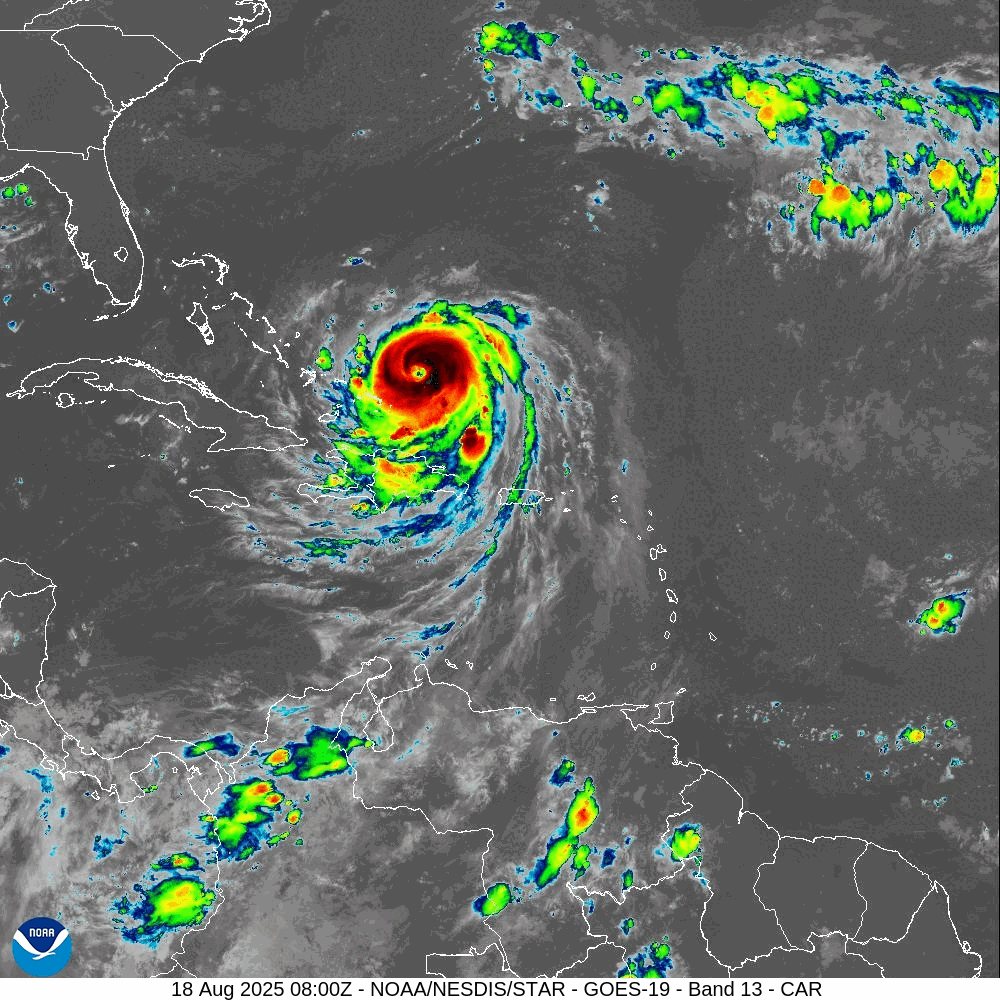
Hurricane Erin has re-intensified into a Category 4 storm with 130 mph winds and is expected to grow larger as it moves through the Atlantic. Though it probably won’t make landfall, it’s bringing dangerous rip currents to the US East Coast, according to CNN. The storm rapidly strengthened to Category 5 earlier, setting records. Heavy rain and flooding have hit Puerto Rico and parts of the Bahamas, prompting evacuations in North Carolina. They write:
Erin is a Category 4 hurricane again, the National Hurricane Center said in its 11 p.m. ET update Sunday, with sustained winds of 130 mph and tropical storm-force winds reaching out 230 miles. The storm was just under a thousand miles southeast of Cape Hatteras, North Carolina as of Sunday evening. […]
The powerful storm has undergone astonishingly rapid changes — a phenomenon that has become far more common in recent years as the planet warms. It quickly became a rare Category 5 for a time Saturday, before weakening and becoming a larger system on Sunday as it churns through the Atlantic Ocean north of the Caribbean.
Erin went from a Category 1 hurricane with 75 mph winds at 11 a.m. Friday to a Category 5 with near 160 mph winds just over 24 hours later. […]
Hurricane Erin is still expected to avoid a direct hit on any land mass, passing north of Puerto Rico, then curving north-northeast into the open Atlantic between the East Coast and Bermuda. As it does so, it is expected to double or even triple in size. […]
Furthermore, Hurricane Erin is now one of only 43 Category 5 hurricanes on record in the Atlantic — which makes it rare, though not as rare in the context of recent hurricane seasons — as peak strength is becoming easier for storms to achieve. It is the 11th Category 5 hurricane recorded in the Atlantic since 2016, an unusually high number.
Read more here.
If you’re willing to fight for Main Street America, click here to sign up for the Richardcyoung.com free weekly email.


